AG-356 Arctic field based Sedimentary systems through time and space (10 ECTS)
ID:
AG-356
CREDITS:
10 ECTS
APPLICATION DEADLINE:
March 01, 2025
START DATE:
June 16, 2025
END DATE:
July 25, 2025
COURSE PERIOD:
Summer course (June-July) - Cancelled summer 2025
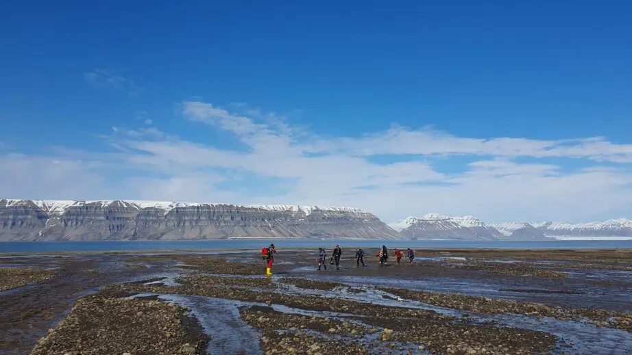
Crossing a river in Sassendalen, June 2023. Photo Carlette Blok/UNIS
| Grade: | Letter grade (A through F) |
| Course Cost: | c. 1000 NOK (depending on options and prices for field localities) |
| Course Capacity Min/Max: | 10/20 students |
| Language of instruction: | English |
| Examination support material: | Bilingual dictionary between English and mother tongue |
Contact person
Course requirements
Enrollment in a relevant master program (for example geology, geography or geoscience). Fundamental understanding of sedimentary environments and description techniques is required (for example achieved through completing AG-209, AG-222, AG-210, AG-211, AG-220, AG-215, AG-214, AG-223 or other introduction to sedimentology/geomorphology/ physical geography /stratigraphy.
Academic content
The course is field-based and uses the unique location of UNIS to study high-arctic landscape, which is influenced by rapid climate change, and study world-class sedimentary outcrops. This creates a unique opportunity to discuss and combine knowledge from modern environments and interpretations of palaeoenvironments.
The course mainly focuses on these three areas: 1) modern sediment distribution (characterization and spatial distribution) in high Arctic terrestrial-coastal deposits in changing climate, 2) description, correlation and interpretation of 2D/3D sedimentary archives from the sedimentary basins in Svalbard and 3) stratigraphic sequences from outcrops and geological data in space and time.
We will discuss current research questions and address themes like: Arctic surface sediments and their response to present climate change, the palaeoclimate archive in the Cretaceous-Paleogene greenhouse world or source-to-sink studies in the Paleogene-Quaternary record. Digital and numerical techniques for data collection and analysis will be introduced. The course is applicable for the student who wants a broader understanding of sedimentary systems through time and space in addition to describing and interpreting sedimentary deposits and outcrops on different scales in the field. Knowledge from this course is relevant for environmental management, description and mapping of sedimentary deposits, subsurface interpretations, and basin analysis.
Learning outcomes
Have an advanced understanding of sedimentary systems in the modern environment and in the rock record. Be able to combine knowledge from the two areas to increase understanding of depositional system dynamics and basin fill geometry.
Understand ther characteristics and signatures of cold-climate sedimentary systems, and be able to identify palaeoclimate signals in the rock record.
Be able to use field mapping, digital outcrops and digital elevation models, core and outcrop logging and modeling to document sedimentological data and apply surface, core and outcrop data to characterization and evaluation of basin fill.
Upon completing the course, the students will:
Knowledge
- Have in-depth understanding of a range of sedimentary environments from modern examples, outcrops and cores, combined with theoretical background.
- Understand how facies models are developed and continually improved through observations and a combination of modern and ancient sedimentary environments with a particular focus on cold-climate/Arctic sedimentary systems and the geological record of Svalbard.
- Understand how knowledge about sedimentary processes, morphologies and sequence stratigraphy contribute to understanding and predicting basin fill configurations.
- Understand how climate signatures can be preserved in lithology, structures and geometry and become familiar with examples from the palaeoclimate record of Svalbard.
Skills
- Be able to identify, measure and describe sedimentary characteristics for modern sedimentary environments, outcrops and core through mapping, logging, correlating and use of state-of-the art digital tools.
- Compare, combine and interpret sedimentological data from process studies, morphological mapping, outcrops, cores and subsurface data and understand the advantages and limitations for each data type.
- Be able to use sequence stratigraphic principles as a tool for stratal correlation and for predicting facies distributions in time and space.
- Get experience with numerical and modeling tools for sedimentological research or problem solving.
- Be able to apply appropriate methods from the toolbox learned in the course, to solve authentic research questions or practical problems requiring sedimentological knowledge.
- Be familiar with how sedimentological knowledge helps us to better understand environmental questions, and improve energy production, pollution distribution and climate models.
General competences
- Have basic competence in planning and performing Arctic/remote field work.
- Build awareness of own previous knowledge and strengths, learn from each other, and build teams of students with complementary skills (team-based learning).
- Gain experience with developing and solving authentic research questions or real-world problems. (problem-based learning and student co-creation of questions and applications).
Learning activities
The learning activities are based on fieldwork. Approximately 7 – 8 field days are estimated for the course, composed of c. 6 full day trips and c. 2 half day trips in the immediate surroundings of UNIS. The field learning is supported by classroom learning activities (lecture components, theoretical background, introduction to methods, seminars to discuss field results), student assignments and preparations for field work.
Summary
- Preassignments, reading etc. – preparatory work: 5 hours.
- Lectures: 10 hours
- Seminars (students active): 25 hours
- Field work (students active): 70 hours
Compulsory learning activities
All compulsory learning activities must be approved in order to sit the exam.
- Participation in field work (or appropriate substitute activity if not able to complete all fieldwork)
- Certification of basic sedimentology competence (techniques)
- Learning reflection journal
Assessment
All assessments must be passed in order to pass the course.
Each assessment is graded, and subsequently combined into a single grade. Partial grades for each assessment will be available.
| Method | Duration |
Percentage of final grade
|
| Oral presentation | 100 % |
