Local wind in the search for renewable energy
As the coal mining industry in Svalbard comes to an end, there is an urgent need to evaluate new energy sources.

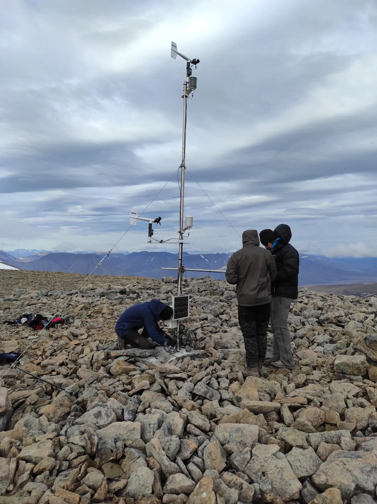
Henkies needed four people to carry all the heavy equipment to the top of Nordenskiöldfjellet, at 1000 metres altitude, in order to collect his measurements. Photo: Matthias Henkies
Text: Maria Philippa Rossi
PhD student Matthias Henkies investigates the wind in the complex terrain of Arctic mountains and fjords to see how it is suitable for wind energy. As part of his project, he looks at the very local behaviour of wind in the valleys.
– As a skier, I occasionally noticed that it was windy in the valley where we live, but not so much on the tops of the mountains.
This happens often in the winter, and these valley winds are called katabatic winds. Nevertheless, Henkies explains of a similar, but far less known phenomenon (at least in the Arctic) that can happen in summer. This was the starting point for a field campaign for the summer of 2022 in Adventdalen: to get more data about the valley winds.
The fieldwork consisted of placing instruments at different locations, mostly automatic weather stations.
– The weather stations track wind speed and direction, as well as temperature and humidity. This turned out to be a more demanding work than we thought initially, as we had to carry the equipment into the field. We placed one weather station at the coast of Adventdalen, one at the slope on the way to Varden on Sverdruphammeren, and – the most demanding one – on the top of Nordenskiöldfjellet.

Henkies needed four people to carry all the heavy equipment to the top of Nordenskiöldfjellet, at 1000 metres altitude. They then spent six hours mounting the weather station before the long hike down.
– Luckily, our technician prepared the weather station so that it would send data once a day, and we did not have to walk up there to download the data every few days.
Summer in Svalbard is short in general, and especially 1000 metres above sea level, so the research team got problems with icing already in late July.
– Within a short time, there were some events when ice and rime layers of several decimetre thickness developed. They made wind measurements impossible because the propeller sensor was completely frozen. The harsh weather up there is also the reason why the demounting trip felt more like a winter expedition than an easy September hike.
Measurements in the valley
In Adventalen, Henkies used a Scanning Doppler Lidar, an instrument, which is also used at airports around the world. A Doppler Lidar measures the wind speed of the air over several kilometres distance remotely. It does this by sending out a short, but harmless laser beam with a certain wavelength, which gets partly reflected by tiny particles in the air (aerosols).
The Lidar receives the reflected light with a possibly slightly different wavelength, depending on the speed by which the air moves. This is called the Doppler effect; and Henkies explains that it is the same effect that you can hear when a moving vehicle makes a sound.
– As an example, if the air moves towards the Lidar in the beam direction, then the wavelength gets shorter, and the Lidar calculates the wind speed from the wavelength difference. With this instrument we gained a lot of information about the wind in Adventdalen, he says.
The data from the Lidar gives information about the wind in the valley in different altitudes, both speeds and directions. Henkies can compare the valley wind with the wind at the top of the mountains to check whether and how the wind is different in the valley.

– The valley wind can, for example, be driven by the top-level wind, but can also be deflected or even blocked by the valley sidewalls. However, there can also be breezes in the valley which are not connected to the wind at higher altitudes; instead, they are driven only by the temperature differences between different parts of Adventdalen or between the valley and the sea.
In addition, during the summer, the sea is usually colder than the land, which creates a wind blowing from sea to land and up-valley. This is called a sea breeze. With all the data he has collected, he can investigate the characteristics of the breeze in Adventdalen.
– For example, how strong the wind blows in various locations during the breeze, or how similar it is to a sea breeze in other places. I also wanted to examine what role the shape of Adventdalen plays.
Henkies is satisfied with the fieldwork and the data collection and spends the dark season analysing the data and drawing conclusions on them.
– Luckily, the fieldwork worked out well enough to get useful data, so I don’t need to repeat the fieldwork next summer, which would be time-consuming and costly again. I hope to find out a lot about how Adventdalen modifies the wind in the lowest layers of the atmosphere, which are especially important for wind energy considerations.