PermaMeteoCommunity
An interdisciplinary project focusing on developing resilience in Arctic communities by providing a climate change response system. This system will assist decision-making by providing real-time key geo-scientific observations affected by the increasing climatic changes, especially the high Arctic environment.
active
The interdisciplinary scientific PermaMeteoCommunity project focuses on developing resilience in Arctic communities by providing a geoscientifically developed coupled permafrost and meteorological climate change response system. This system will assist decision-making by providing real-time key geoscientific observations. These are important particularly with increasing climatic changes taking place in the high Arctic environment such as in Svalbard.
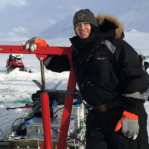
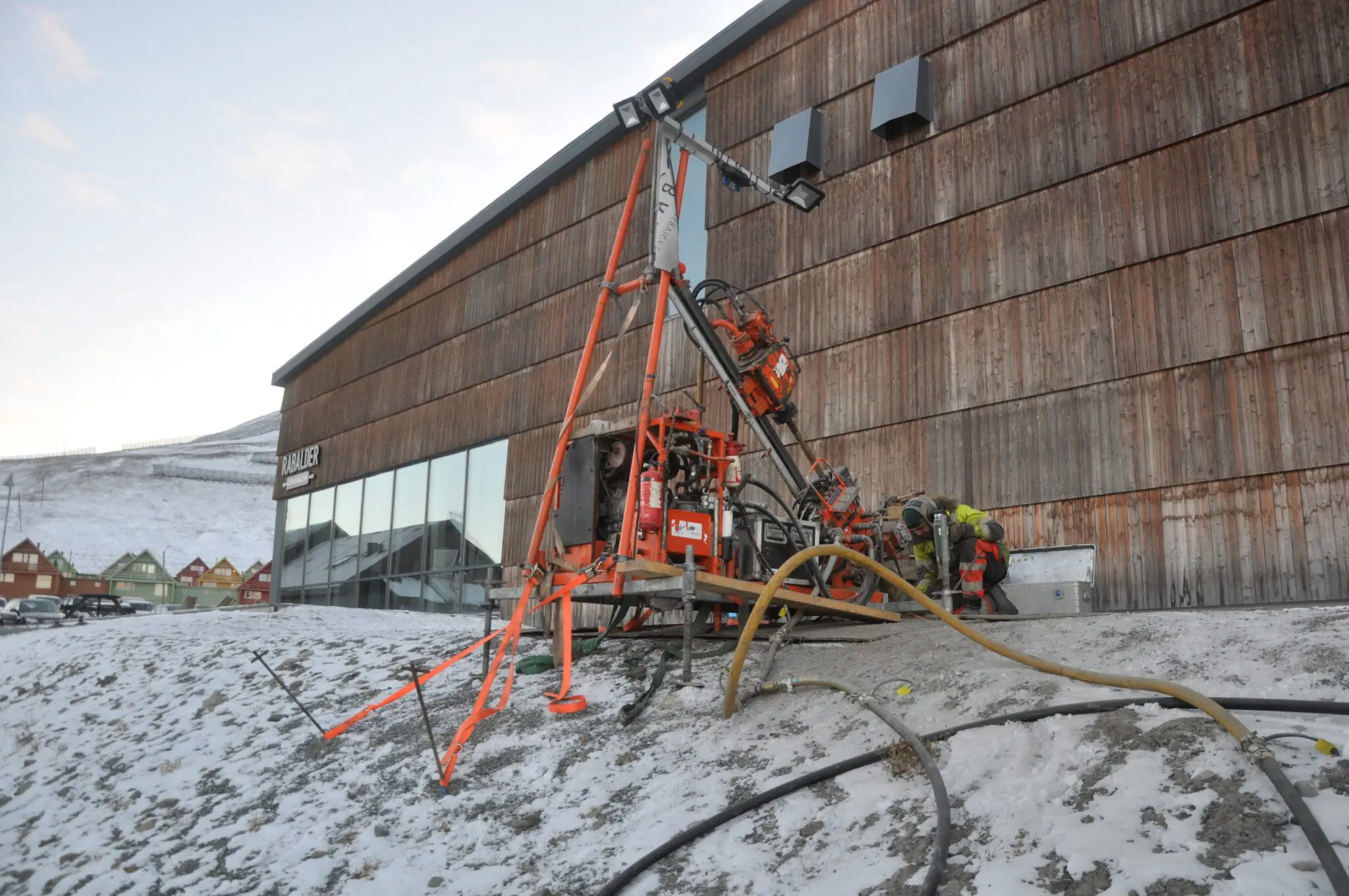
We investigate permafrost in the different landforms in the Longyearbyen area using geophysical and geotechnical measurements, and drill into the permafrost collecting cores from the active layer and permafrost, to be able to analyse the ground ice content and type, thermal properties, age and grain-size of the sediment.
We train the next generation of arctic experts within all parts of the project. UNIS course and thesis students are involved in the project by doing part of their course activities and/or full-scale thesis studies within the project. The project will, in particular, enhance the amount of directly useful data and real-work life experiences that students can experience in their UNIS studies.
Longyearbyen is an excellent test site for developing such forward-looking technology to provide safer and better living conditions for the inhabitants. The developed response system aims to be exportable to other polar or cold climatic areas, with permafrost or seasonal frost, which are most affected by climate change. This way, Longyearbyen will be a showcase for how to handle climate change and build resilience in Arctic communities. It can be expanded with other observations and modelling components for further development and improvement.
Geophysical and geotechnical mapping (WP1)
Saline soil conditions pose a considerable geotechnical challenge in permafrost settings due to the influence of pore-water salinity on the soil strength and deformation susceptibility. Increased salinity reduces the soil’s ice content, resulting in reduced strength and increased creep rates at a given temperature. Observations in Longyearbyen by local authorities, drill operators, and consultancies suggest that saline marine clays underlay much of the town area below ca. 65 m a.s.l, The objectives of this WP are to characterise and map the distribution of saline permafrost to anticipate the geotechnical effects of climate change in support of municipal planning and preparedness in the Longyearbyen area.
The specific objectives are to: (1) analyse index parameters and perform secondary geotechnical and thermodynamic testing on the saline marine clay samples to assess their sensitivity to temperature change; (2) interpolate between boreholes using modern geophysical methods (specifically ERT and GPR); (3) develop CPTu as a rapid, cost-effective method to characterize permafrost soil stratigraphy and monitor the behavioural change of saline permafrost soils during climate warming; (4) map the thickness and distribution of saline soils underlying Longyearbyen and the total thickness of the unconsolidated sediment cover (i.e. depth to bedrock) using geophysics and (5) instrument boreholes to monitor temperature regime under foundations on cooling plates and further validate thermal modelling.
Ground ice mapping (WP2)
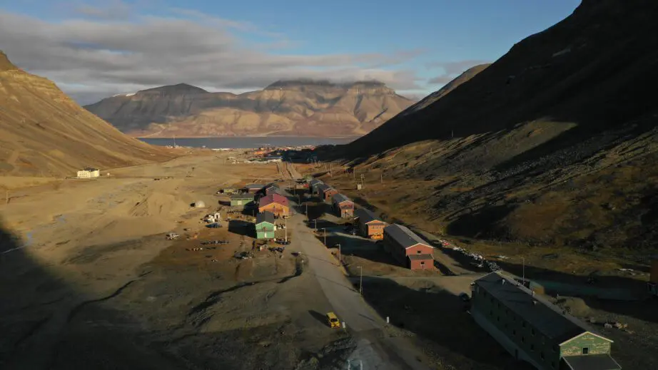
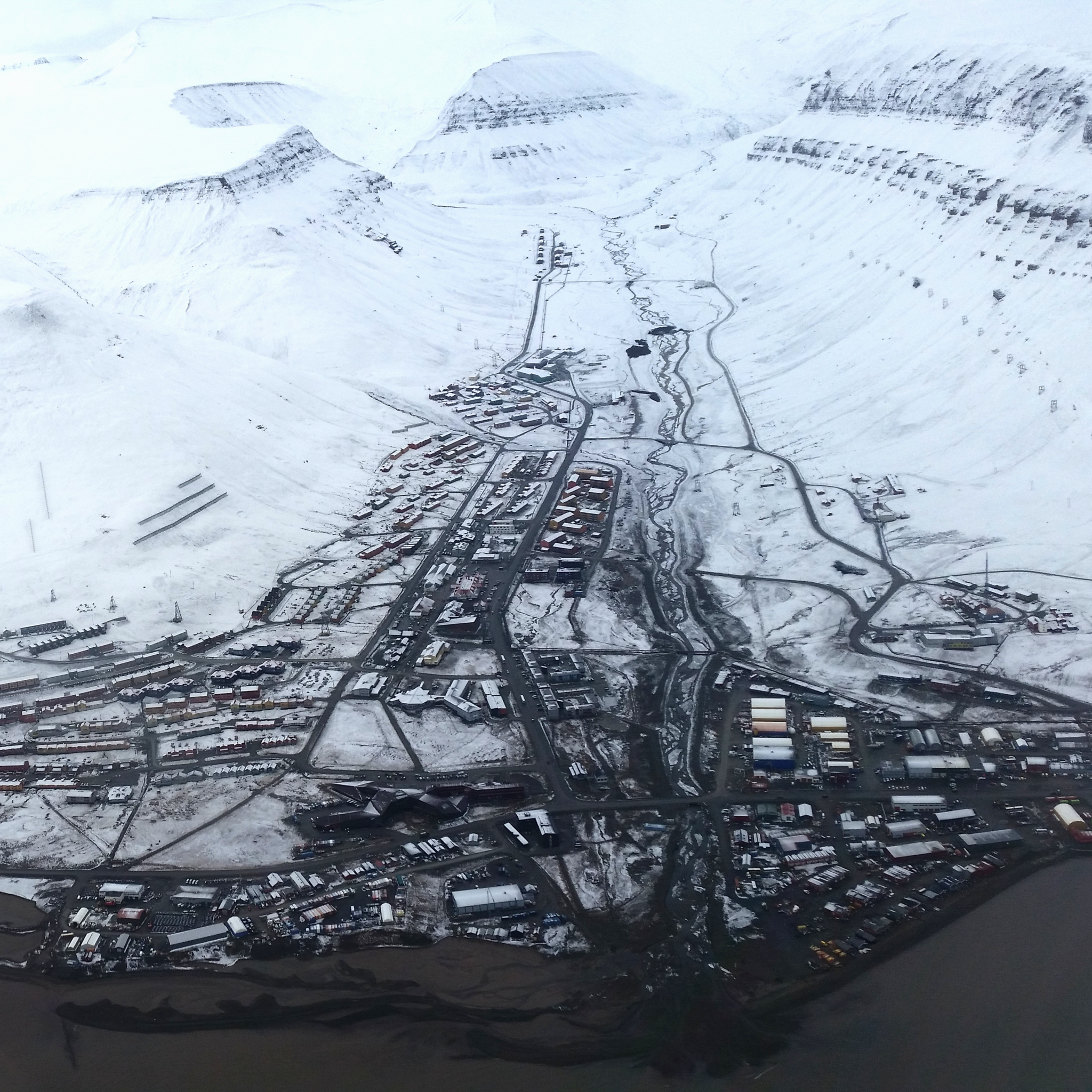
Longyearbyen is located in a narrow valley, characteristic of the high-relief landscape of central Svalbard, within the continuous permafrost zone. Permafrost is both a barrier to infiltration and a moisture source, as water is released during the melting of ground ice. Investigations from Longyearbyen have documented landsliding following periods of heavy summer rainfall in 1972. Widespread slope failure also occurred in autumn 2016, during and following two periods of heavy precipitation. During all these events, debris flows and active – layer detachment slides resulted in road closures, damage to infrastructure and evacuations of properties near to the base of hillslopes.
In WP2 we quantify and map the ground ice content in the permafrost in Longyeardalen valley. More specifically we drill and retrieve sediment cores from the different landforms within the Longyeardalen valley, mainly short through the active layer down min. 3 m into the permafrost, but also some deeper boreholes penetrating the sediment infilling the valley all over the lower valley part. We perform laboratory analyses to determine the cryostratigraphy and grain size in the frozen active layer and top permafrost of the different landforms, so that we can develop a detailed ground ice map. All data and maps will be available as part of the digital database in the response system to be developed in WP4.
Assessment of the sensitivity of the high-relief terrain in and surrounding Longyearbyen to climate change requires detailed understanding of ground ice conditions. This is done by linking the results of the WP1 and WP2 investigations with the new Quaternary sediment cover and geomorphological map of the Longyeardalen area.
Thermo-mechanical modelling (WP3)
The effect of climate warming in permafrost regions may cause unacceptable risks for infrastructure and buildings according to existing engineering design. For engineering purposes, knowledge of the content and distribution of ice in sediments is essential as ice significantly affects mechanical soil properties. The bearing capacity of the soil, i.e. the capacity to support a given load without being significantly deformed, is related to soil type and grain-size distribution, and the content of ice and unfrozen water. We determine these parameters for the Longyeardalen study area in WP 1 and WP2. This enables thermo-mechanical assessment of the site-specific climate impact in Longyearbyen, and gives input to assess the probability of unacceptable deformations or failure of soil foundations.
The model is being developed as a coupled geothermal and mechanical model. The model aims to investigate the temperature-dependent deformation properties of the permafrost soils and how it affects the surface subsidence and settlement. Risk assessments can then be carried out, investigating the vulnerability of various areas, landforms, structures and infrastructure in the Longyearbyen area to climate warming scenarios. We will integrate the model output into the response system and provide short-term model output.
Building an online permafrost and meteorological response system (WP4)
The high relief landscape of Longyearbyen causes very large local variability in weather and this is especially evident in temperature and precipitation. Permafrost and active layer processes such as thawing and freezing are intimately connected to these weather parameters. Simultaneously monitoring both the atmosphere and the ground below is therefore key in understanding and forecasting conditions that can lead to debris flows and active layer detachment slides. These potentially hazardous processes are becoming more relevant with climate change, as the autumn season is becoming increasingly longer, wetter and warmer.
Until recently, the corresponding weather and ground observations have been lacking in Longyearbyen or they have not been easily accessible or systemised in a coordinated manner. In this WP, we build a real-time, observation-based online system consisting of (1) instrumented permafrost boreholes for direct observations of ground temperature and pore water pressure in the active layer and top permafrost where we know the ground ice content (from WP2), (2) a network of weather stations which records key parameters such as air temperature, precipitation with high temporal resolution in different parts of the Longyearbyen valley area and (3) an open online platform that receives and displays all this data in near real-time directly for all relevant users.
In addition, we are will enhance the system with two more components: 1) synthetic aperture radar (SAR) data from satellites to map movement of the land surface and 2) very high-resolution weather simulations that resolve atmospheric processes on the local slopes of the Longyearbyen area and can be invoked on an on-demand basis for example for preparedness situations. The target users of our response systems range from the local authorities who make decisions for example related to evacuations in relation to preparedness situations, and researchers and students who will use the data in their studies.

More information:
https://www.arcticcircle.org/frederik-paulsen-arctic-academic-action-award
https://www.uarctic.org/news/2022/10/fp-award-winners-we-care-about-how-the-society-we-are-living-in-is-functioning/