SVALCOAST
The Svalcoast webpage is a dynamic hub/gateway for maps, data and research results related to coastal processes, sediments and landforms on Svalbard.
active
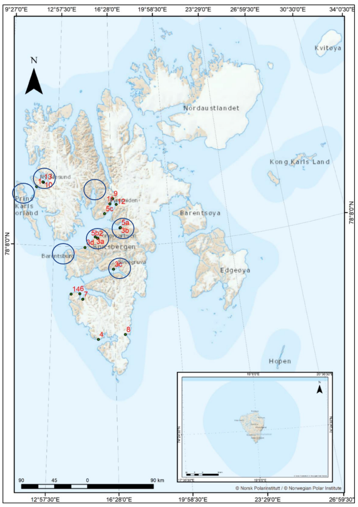
Ongoing and past Svalcoast projects focus area
- Adventfjorden
- Dicksonfjorden
- Gipsvika
- Hollendarbukta
- Nordenskiöldkysten (north)
- Prins Karls Forland
- Sassenfjorden
- Van Mijenfjorden
Ongoing research projects on Svalbard are related to the DynaCoast and Catchment to Coast (C2C) projects.
DynaCoast
Initiated in response to the need for knowledge of fast coastal change in the Isfjorden area, combined with the lack of geomorphological maps to record and document coastal dynamics. There is a need for a geomorphological and sedimentological baseline for future research and monitoring of landscape and process change over time – since also topographic map data on Svalbard is are new and geomorphological data therefore is scarce.
Catchment to Coast
The Catchment to Coast project (C2C) monitors the impact of climate change on terrestrial, coastal and marine ecosystems. C2C concentrates on four fjord systems, three on mainland Norway and one on Svalbard, with many institutes, universities and research centres involved. Our aim on Svalbard is to better understand the coastal changes in Adventdalen/ Adventfjorden. More information about the C2C project can be found here.
The Svalcoast geodatabase can be used to create new maps relevant for area management or combined with existing maps from the planning authorities in Longyearbyen and Svalbard.